
Lakeside topographic map
Interactive map
Click on the map to display elevation.
About this map
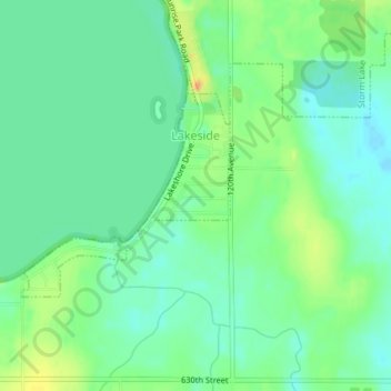
Name: Lakeside topographic map, elevation, terrain.
Location: Lakeside, Buena Vista County, Iowa, United States (42.61027 -95.19080 42.62432 -95.17121)
Average elevation: 427 m
Minimum elevation: 415 m
Maximum elevation: 448 m
Other topographic maps
Click on a map to view its topography, its elevation and its terrain.
Sulphur Springs
United States > Iowa > Buena Vista County
Sulphur Springs, Buena Vista County, Iowa, United States
Average elevation: 400 m