
Tempelhof topographic map
Interactive map
Click on the map to display elevation.
About this map
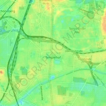
Name: Tempelhof topographic map, elevation, terrain.
Location: Tempelhof, Tempelhof-Schöneberg, Berlin, Germany (52.44414 13.35571 52.48582 13.42659)
Average elevation: 47 m
Minimum elevation: 33 m
Maximum elevation: 64 m
Other topographic maps
Click on a map to view its topography, its elevation and its terrain.