Geolocate

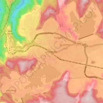
Lonavala topographic map

Click on the map to display elevation.

Lonavala

Adjacent to the Lohagad fort lies the visapur fort which is part of the Lohagad-Visapur fortification. Visapur Fort is larger and at a higher elevation than its twin- Lohagad. It was built during 1713-1720 CE by Balaji Vishwanath.

Wikipedia (CC-BY-SA 3.0)

About this map

Name: Lonavala topographic map, elevation, terrain.

Location: Lonavala, Mawal, Pune District, Maharashtra, 410400, India (18.71486 73.36167 18.79486 73.44167)

Average elevation: 613 m

Minimum elevation: 136 m

Maximum elevation: 882 m

Gear up for your next adventure:

🧼Biodegradable Outdoor Soap - Clean gear and yourself without harming the local ecosystem
🛰️Handheld GPS Units - Rugged GPS devices for tracking coordinates and elevation in the Australian bush
⌚Altimeter Barometer Watches - Outdoor watches with built-in sensors to track altitude changes and weather shifts
🐍Snake Gaiters - Protection against snake bites
🧯Animal Deterrent Spray - Safety spray for wildlife

As an Amazon Associate, this site earns from qualifying purchases at no extra cost to you.