Geolocate

Tanay topographic map

Click on the map to display elevation.

About this map

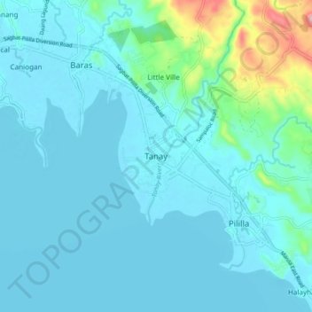
Name: Tanay topographic map, elevation, terrain.

Location: Tanay, Rizal, Calabarzon, 1980, Philippines (14.45854 121.24563 14.53854 121.32563)

Average elevation: 32 m

Minimum elevation: 0 m

Maximum elevation: 256 m

Gear up for your next adventure:

🏫Topographic World Globes - 3D physical relief globes to understand global geography
📣High-Decibel Survival Whistles - Signaling tool for rescue that carries much further than a human voice
🐍Australian Snake Bite Kits - Specific pressure immobilization bandages for Australian venomous snakes
🌧️Rain Jackets - Waterproof jackets for hiking
🏕️Camping Gear - Essential camping equipment

As an Amazon Associate, this site earns from qualifying purchases at no extra cost to you.