
Thank you for supporting this site ❤️
Make a donation
Make a donation
Gear up for your next adventure:
As an Amazon Associate, this site earns from qualifying purchases at no extra cost to you.
Kemble topographic map
Click on the map to display elevation.
Thank you for supporting this site ❤️
Make a donation
Make a donation
Gear up for your next adventure:
As an Amazon Associate, this site earns from qualifying purchases at no extra cost to you.
About this map
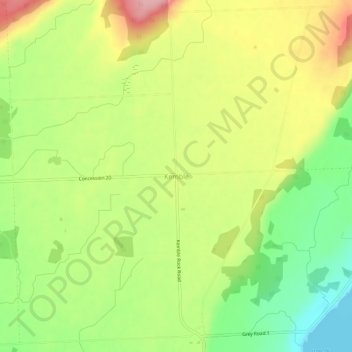
Name: Kemble topographic map, elevation, terrain.
Location: Kemble, Georgian Bluffs, Grey County, Ontario, Canada (44.70439 -80.95167 44.74439 -80.91167)
Average elevation: 243 m
Minimum elevation: 174 m
Maximum elevation: 319 m
Thank you for supporting this site ❤️
Make a donation
Make a donation
Gear up for your next adventure:
As an Amazon Associate, this site earns from qualifying purchases at no extra cost to you.