Geolocate

Kitsilano topographic map

Click on the map to display elevation.

About this map
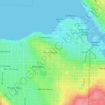
Name: Kitsilano topographic map, elevation, terrain.

Location: Kitsilano, Vancouver, Metro Vancouver Regional District, British Columbia, Canada (49.25717 -123.18614 49.27921 -123.13883)

Average elevation: 24 m

Minimum elevation: -3 m

Maximum elevation: 86 m

Other topographic maps

Click on a map to view its topography, its elevation and its terrain.
Gear up for your next adventure:

📡Portable Emergency Radios - Stay informed about weather warnings and bushfire alerts
🖼️Scratch-off Australia Map - Track the regions and peaks you have explored geographically
🔋Solar Power Banks - Solar chargers for outdoors
👟Lightweight Trail Runners - Agile footwear for fast movement over rugged Australian terrain
🎨Portable Watercolor Kits - Paint the landscapes and topographic views you discover

As an Amazon Associate, this site earns from qualifying purchases at no extra cost to you.