Antipolo topographic map
Click on the map to display elevation.
Antipolo
Its higher elevation than that of Metro Manila affords it a scenic view of the metropolis, especially at night. Its locally grown mangoes and cashews are popular among tourists, as well as suman – a local delicacy made out of glutinous rice. The Hinulugang Taktak National Park, which was once a popular summer get-away is being restored to become again one of the city's primary attractions because it was devastated by a typhoon.
About this map
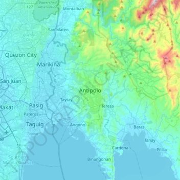
Name: Antipolo topographic map, elevation, terrain.
Location: Antipolo, Rizal, Calabarzon, 1870, Philippines (14.42720 121.01592 14.74720 121.33592)
Average elevation: 125 m
Minimum elevation: -2 m
Maximum elevation: 1,140 m
Other topographic maps
Click on a map to view its topography, its elevation and its terrain.