
Stone Mills topographic map
Interactive map
Click on the map to display elevation.
About this map
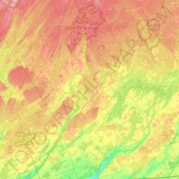
Name: Stone Mills topographic map, elevation, terrain.
Average elevation: 164 m
Minimum elevation: 86 m
Maximum elevation: 254 m
Other topographic maps
Click on a map to view its topography, its elevation and its terrain.
Tamworth
Canada > Ontario > Lennox and Addington County > Stone Mills
Tamworth, Stone Mills, Lennox and Addington County, Eastern Ontario, Ontario, K0K 3G0, Canada
Average elevation: 166 m
Napanee River
Canada > Ontario > Lennox and Addington County > Greater Napanee
Napanee River, Greater Napanee, Lennox and Addington County, Eastern Ontario, Ontario, K7R 3K8, Canada
Average elevation: 80 m