
Kitchener topographic map
Click on the map to display elevation.
Kitchener
Kitchener is located in Southwestern Ontario, in the Saint Lawrence Lowlands. This geological and climatic region has wet-climate soils and deciduous forests. Situated in the Grand River Valley, the area is generally above 300 m (1,000 ft) in elevation.
About this map
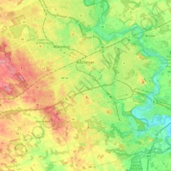
Name: Kitchener topographic map, elevation, terrain.
Location: Kitchener, Region of Waterloo, Ontario, Canada (43.35388 -80.57346 43.50683 -80.37841)
Average elevation: 336 m
Minimum elevation: 272 m
Maximum elevation: 419 m