Geolocate

Cannington topographic map

Click on the map to display elevation.

About this map
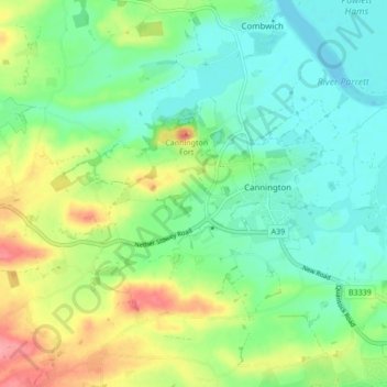
Name: Cannington topographic map, elevation, terrain.

Location: Cannington, Somerset, England, United Kingdom (51.12622 -3.11622 51.17445 -3.03098)

Average elevation: 29 m

Minimum elevation: -2 m

Maximum elevation: 88 m

Other topographic maps

Click on a map to view its topography, its elevation and its terrain.
Cannington Fort

United Kingdom > England > Somerset > Cannington

Average elevation: 22 m

Gear up for your next adventure:

🌬️Windbreaker Jackets - Wind protection jackets
🦟Heavy Duty Insect Repellent - Essential protection against flies, mozzies, and march flies
🍳Camping Cookware - Cookware sets for outdoor meals
👣Snake & Scrub Gaiters - Protection against spinifex, mud, and snakes while walking off-track
🦟Insect Repellent - Protection against insects

As an Amazon Associate, this site earns from qualifying purchases at no extra cost to you.