
Thank you for supporting this site ❤️
Make a donation
Make a donation
Gear up for your next adventure:
As an Amazon Associate, this site earns from qualifying purchases at no extra cost to you.
Benthuizen topographic map
Click on the map to display elevation.
Thank you for supporting this site ❤️
Make a donation
Make a donation
Gear up for your next adventure:
As an Amazon Associate, this site earns from qualifying purchases at no extra cost to you.
About this map
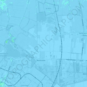
Name: Benthuizen topographic map, elevation, terrain.
Location: Benthuizen, Alphen aan den Rijn, South Holland, Netherlands (52.05857 4.53010 52.12043 4.60743)
Average elevation: -3 m
Minimum elevation: -9 m
Maximum elevation: 4 m
Thank you for supporting this site ❤️
Make a donation
Make a donation
Gear up for your next adventure:
As an Amazon Associate, this site earns from qualifying purchases at no extra cost to you.