
Phường Sông Đà topographic map
Interactive map
Click on the map to display elevation.
About this map
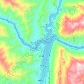
Name: Phường Sông Đà topographic map, elevation, terrain.
Location: Phường Sông Đà, Mường Lay, Điện Biên Province, Vietnam (22.04780 103.09003 22.10138 103.19160)
Average elevation: 603 m
Minimum elevation: 166 m
Maximum elevation: 1,485 m