Geolocate

Yanjin County topographic map

Click on the map to display elevation.

About this map

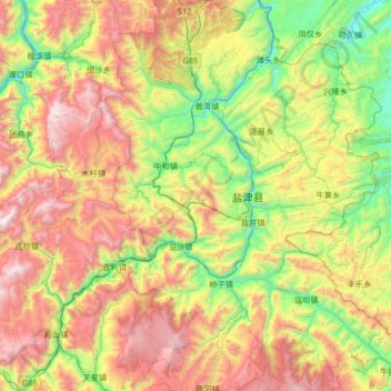
Name: Yanjin County topographic map, elevation, terrain.

Location: Yanjin County, Zhaotong City, Yunnan, China (27.82071 103.98916 28.40540 104.45888)

Average elevation: 1,163 m

Minimum elevation: 336 m

Maximum elevation: 2,439 m

Other topographic maps

Click on a map to view its topography, its elevation and its terrain.

Shashu

China > Yunnan > Zhaotong City

Average elevation: 1,429 m

Gear up for your next adventure:

👄SPF Lip Balm - Prevent sun and wind-burnt lips on mountain ridges
🔋Solar Power Banks - Charge your phone and GPS using the sun while deep in the bush
📡Satellite Messengers - Emergency communication devices
🚴Bike GPS - GPS devices for cycling
📖Australian Bush Survival Books - Local knowledge on finding water and surviving the outback

As an Amazon Associate, this site earns from qualifying purchases at no extra cost to you.