
Thank you for supporting this site ❤️
Make a donation
Make a donation
Gear up for your next adventure:
As an Amazon Associate, this site earns from qualifying purchases at no extra cost to you.
Mel topographic map
Click on the map to display elevation.
Thank you for supporting this site ❤️
Make a donation
Make a donation
Gear up for your next adventure:
As an Amazon Associate, this site earns from qualifying purchases at no extra cost to you.
About this map
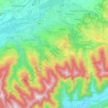
Name: Mel topographic map, elevation, terrain.
Location: Mel, Borgo Valbelluna, Belluno, Veneto, 32026, Italy (45.96021 12.02585 46.09083 12.16974)
Average elevation: 598 m
Minimum elevation: 204 m
Maximum elevation: 1,358 m
Thank you for supporting this site ❤️
Make a donation
Make a donation
Gear up for your next adventure:
As an Amazon Associate, this site earns from qualifying purchases at no extra cost to you.