
Thank you for supporting this site ❤️
Make a donation
Make a donation
Gear up for your next adventure:
As an Amazon Associate, this site earns from qualifying purchases at no extra cost to you.
Hintersee topographic map
Click on the map to display elevation.
Thank you for supporting this site ❤️
Make a donation
Make a donation
Gear up for your next adventure:
As an Amazon Associate, this site earns from qualifying purchases at no extra cost to you.
About this map
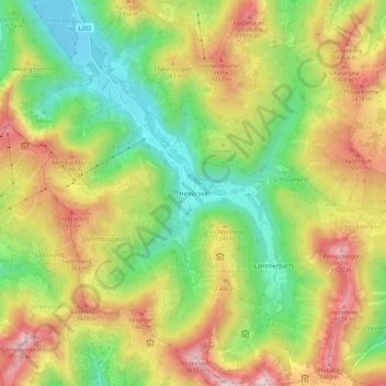
Name: Hintersee topographic map, elevation, terrain.
Location: Hintersee, Bezirk Salzburg-Umgebung, Salzburg, 5324, Austria (47.67465 13.23237 47.75206 13.34025)
Average elevation: 1,117 m
Minimum elevation: 681 m
Maximum elevation: 1,695 m
Thank you for supporting this site ❤️
Make a donation
Make a donation
Gear up for your next adventure:
As an Amazon Associate, this site earns from qualifying purchases at no extra cost to you.