Geolocate

Parintins topographic map

Click on the map to display elevation.

About this map
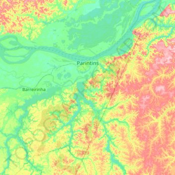
Name: Parintins topographic map, elevation, terrain.

Location: Parintins, Região Geográfica Imediata de Parintins, Região Geográfica Intermediária de Parintins, Amazonas, North Region, Brazil (-3.33300 -57.42901 -2.24200 -56.38900)

Average elevation: 38 m

Minimum elevation: 0 m

Maximum elevation: 137 m

Other topographic maps

Click on a map to view its topography, its elevation and its terrain.

Juami River

Brazil > Amazonas > Japurá

Juami River is a black water river, a tributary of the white water Japurá River, and runs through the Amazon plain. The entire basin of the Juami River is contained within the Juami-Japurá Ecological Station. The basin has altitudes that range from 45 to 450 metres (148 to 1,476 ft) above sea level.

Average elevation: 109 m

Gear up for your next adventure:

🦯Trekking Poles - Walking poles for hiking stability
🏫Topographic World Globes - 3D physical relief globes to understand global geography
📕Hiking Guide Books - Guides for hiking trails
📦Crushproof Equipment Cases - Safe transport for sensitive surveying and mapping instruments
📣High-Decibel Survival Whistles - Signaling tool for rescue that carries much further than a human voice

As an Amazon Associate, this site earns from qualifying purchases at no extra cost to you.