
Thank you for supporting this site ❤️
Make a donation
Make a donation
Gear up for your next adventure:
As an Amazon Associate, this site earns from qualifying purchases at no extra cost to you.
Keller topographic map
Click on the map to display elevation.
Thank you for supporting this site ❤️
Make a donation
Make a donation
Gear up for your next adventure:
As an Amazon Associate, this site earns from qualifying purchases at no extra cost to you.
About this map
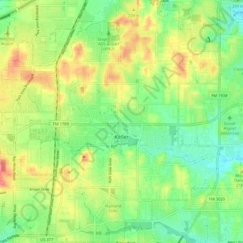
Name: Keller topographic map, elevation, terrain.
Location: Keller, Tarrant County, Texas, 76248, United States (32.89237 -97.26615 32.97857 -97.17680)
Average elevation: 213 m
Minimum elevation: 183 m
Maximum elevation: 252 m
Thank you for supporting this site ❤️
Make a donation
Make a donation
Gear up for your next adventure:
As an Amazon Associate, this site earns from qualifying purchases at no extra cost to you.
Other topographic maps
Click on a map to view its topography, its elevation and its terrain.
Forest Hill
United States > Texas > Tarrant County > Forest Hill > Forest Hill
Average elevation: 195 m