Geolocate

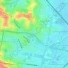
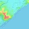
Newcastle topographic map

Click on the map to display elevation.

About this map
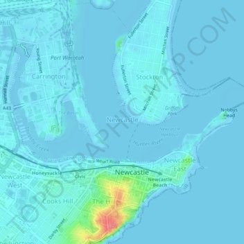
Name: Newcastle topographic map, elevation, terrain.

Location: Newcastle, Newcastle-Maitland, New South Wales, 2300, Australia (-32.93781 151.75963 -32.90148 151.80393)

Average elevation: 5 m

Minimum elevation: -3 m

Maximum elevation: 76 m

New South Wales trails, hiking, mountain biking, running and outdoor activities

Other topographic maps

Click on a map to view its topography, its elevation and its terrain.
Jesmond Park

Australia > New South Wales > Newcastle

Average elevation: 35 m

Cameron Park

Australia > New South Wales > Newcastle

Average elevation: 23 m

Glenrock Lagoon

Australia > New South Wales > Newcastle

Average elevation: 39 m

Nobbys Beach

Australia > New South Wales > Newcastle

Average elevation: 3 m

Redhead Bluff

Australia > New South Wales > Newcastle

Average elevation: 13 m

Dixon Park

Australia > New South Wales > Newcastle

Average elevation: 12 m

Gear up for your next adventure:

🎒Dry Bags - Waterproof bags for outdoor gear
🔦LED Torches - LED torches for outdoor use
👄SPF Lip Balm - Prevent sun and wind-burnt lips on mountain ridges
🪫Rechargeable Headlamps - USB rechargeable headlamps
🆘Personal Locator Beacons (PLB) - Satellite emergency beacons for life-saving help in areas with no mobile coverage

As an Amazon Associate, this site earns from qualifying purchases at no extra cost to you.