Geolocate

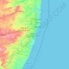
Flores topographic map

Click on the map to display elevation.

About this map

Name: Flores topographic map, elevation, terrain.

Location: Flores, Região Geográfica Imediata de Serra Talhada, Região Geográfica Intermediária de Serra Talhada, Pernambuco, Northeast Region, Brazil (-8.08433 -38.10564 -7.76601 -37.69152)

Average elevation: 598 m

Minimum elevation: 428 m

Maximum elevation: 1,166 m

Other topographic maps

Click on a map to view its topography, its elevation and its terrain.

Usina de Arte

Brazil > Pernambuco > Água Preta

Average elevation: 114 m

Gear up for your next adventure:

👣Snake & Scrub Gaiters - Protection against spinifex, mud, and snakes while walking off-track
🧦Merino Wool Hiking Socks - Moisture-wicking socks to prevent blisters during long topographic surveys
🩹Blister Prevention Tape - Apply to friction points before they become painful sores
📡Weather Radios - Emergency weather radios
🎨Portable Watercolor Kits - Paint the landscapes and topographic views you discover

As an Amazon Associate, this site earns from qualifying purchases at no extra cost to you.