

Cortona topographic map
Click on the map to display elevation.
Cortona
The prevailing character of Cortona's architecture is medieval with steep narrow streets situated on a hillside at an elevation of 600 metres (2,000 ft) that embraces a view of the whole of the Valdichiana. From the Piazza Garibaldi (still referred to by the local population by its older name, Piazza Carbonaia) is a fine prospect of Lake Trasimeno, scene of Hannibal's ambush of the Roman army in 217 BC (Battle of Lake Trasimene).
About this map
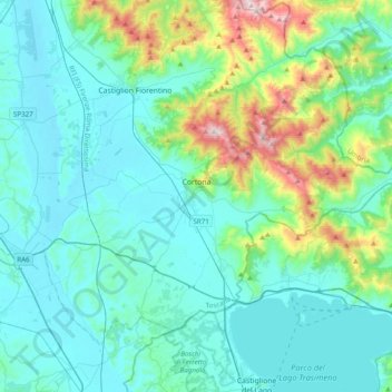
Name: Cortona topographic map, elevation, terrain.
Location: Cortona, Arezzo, Tuscany, Italy (43.15634 11.83351 43.37221 12.22465)
Average elevation: 375 m
Minimum elevation: 238 m
Maximum elevation: 1,063 m