

Vigan topographic map
Click on the map to display elevation.
Vigan
Vigan is situated in a Quaternary Age sedimentary plain called the Vigan-Bantay Plain which is part of the Ilocos coastal plain. The Vigan-Bantay Plain is bounded on the east by a moderately rugged Miocene sediments consisting of interbedded sandstones and shale to very rugged Meta-volcanics and Meta sediment topography; on the south is the Municipality of Santa where the north–south trending fault terminates; to the west is the South China Sea; while the northern boundary opens to the northern extension of the Ilocos coastal plain.
About this map
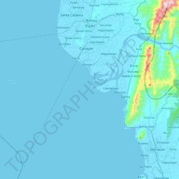
Name: Vigan topographic map, elevation, terrain.
Location: Vigan, Ilocos Sur, Ilocos Region, 2700, Philippines (17.39840 120.19585 17.59134 120.43231)
Average elevation: 34 m
Minimum elevation: -1 m
Maximum elevation: 748 m