Geolocate

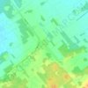
Howick topographic map

Click on the map to display elevation.

About this map

Name: Howick topographic map, elevation, terrain.

Location: Howick, Le Haut-Saint-Laurent, Montérégie, Quebec, Canada (45.18002 -73.86311 45.19759 -73.84385)

Average elevation: 39 m

Minimum elevation: 32 m

Maximum elevation: 45 m

Other topographic maps

Click on a map to view its topography, its elevation and its terrain.

Snye

Canada > Quebec > Le Haut-Saint-Laurent > Snye

Average elevation: 49 m

Cazaville

Canada > Quebec > Le Haut-Saint-Laurent

Average elevation: 58 m

Covey Hill

Canada > Quebec > Le Haut-Saint-Laurent > Havelock

Average elevation: 283 m

Doréa

Canada > Quebec > Le Haut-Saint-Laurent > Franklin

Average elevation: 242 m

Gear up for your next adventure:

🔋Solar Power Banks - Solar chargers for outdoors
👟Lightweight Trail Runners - Agile footwear for fast movement over rugged Australian terrain
🚗Car Camping Gear - Equipment for vehicle camping
🧥Insulated Down Jackets - High warmth-to-weight ratio for cold nights in the high country
🌿Flora and Fauna Field Guides - Identify the plants and animals you encounter on your route

As an Amazon Associate, this site earns from qualifying purchases at no extra cost to you.