Geolocate

Mead topographic map

Click on the map to display elevation.

About this map

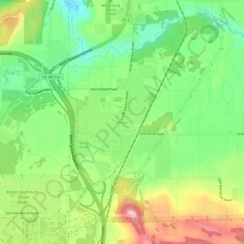
Name: Mead topographic map, elevation, terrain.

Location: Mead, Spokane County, Washington, 99021, United States (47.74739 -117.37494 47.78739 -117.33494)

Average elevation: 585 m

Minimum elevation: 511 m

Maximum elevation: 690 m

Gear up for your next adventure:

🧼Biodegradable Soap - Eco-friendly outdoor soap
🔪Camping Knives - Multi-purpose outdoor knives
🥤Outdoor Water Bottles - Reusable bottles for outdoor activities
🧢Outdoor Sun Hats - Sun protection hats for hiking
🔥Windproof Plasma Lighters - USB rechargeable lighters that work in high-altitude winds

As an Amazon Associate, this site earns from qualifying purchases at no extra cost to you.