
Mount Vernon topographic map
Interactive map
Click on the map to display elevation.
About this map
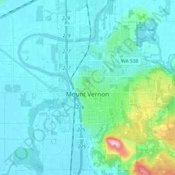
Name: Mount Vernon topographic map, elevation, terrain.
Average elevation: 37 m
Minimum elevation: 0 m
Maximum elevation: 288 m
Other topographic maps
Click on a map to view its topography, its elevation and its terrain.
Concrete
United States > Washington > Skagit County
Concrete, Skagit County, Washington, United States
Average elevation: 125 m