
Mezaourou topographic map
Interactive map
Click on the map to display elevation.
About this map
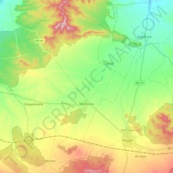
Name: Mezaourou topographic map, elevation, terrain.
Location: Mezaourou, Telagh District, Sidi Bel Abbès, 22025, Algeria (34.74630 -0.74504 34.92481 -0.57438)
Average elevation: 856 m
Minimum elevation: 679 m
Maximum elevation: 1,149 m