Geolocate
👉 Easily get elevation data in JSON, GeoTIFF and KML formats using Elevation API
Thank you for supporting this site ❤️
Make a donation

Port Dickson topographic map

Click on the map to display elevation.

About this map

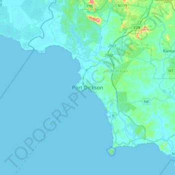
Name: Port Dickson topographic map, elevation, terrain.

Location: Port Dickson, Negeri Sembilan, 71000, Malaysia (2.36625 101.65062 2.68625 101.97062)

Average elevation: 14 m

Minimum elevation: -2 m

Maximum elevation: 235 m

Gear up for your next adventure:

🎒3L Hydration Reservoirs - Hands-free drinking to stay hydrated on steep contour climbs
Ultralight Solo Tents - Compact shelters for multi-day topographic surveying expeditions
👄SPF Lip Balm - Prevent sun and wind-burnt lips on mountain ridges
Survival Blankets - Emergency thermal blankets
🛠️Outdoor Repair Kits - Gear repair kits

As an Amazon Associate, this site earns from qualifying purchases at no extra cost to you.