
Kelsall topographic map
Click on the map to display elevation.
About this map
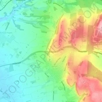
Name: Kelsall topographic map, elevation, terrain.
Location: Kelsall, Cheshire West and Chester, England, United Kingdom (53.19655 -2.75232 53.23044 -2.69301)
Average elevation: 85 m
Minimum elevation: 26 m
Maximum elevation: 177 m
Other topographic maps
Click on a map to view its topography, its elevation and its terrain.
Kingswood Park
United Kingdom > England > Cheshire West and Chester > Manley > Kingswood Park
Average elevation: 114 m