Geolocate

New Waverly topographic map

Click on the map to display elevation.

👉 Easily get elevation data in JSON, GeoTIFF and KML formats using Elevation API
Thank you for supporting this site ❤️
Make a donation

Gear up for your next adventure:

As an Amazon Associate, this site earns from qualifying purchases at no extra cost to you.

About this map

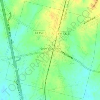
Name: New Waverly topographic map, elevation, terrain.

Location: New Waverly, Walker County, Texas, United States (30.52405 -95.49733 30.55049 -95.46838)

Average elevation: 104 m

Minimum elevation: 91 m

Maximum elevation: 118 m

Gear up for your next adventure:

🧥Insulated Down Jackets - High warmth-to-weight ratio for cold nights in the high country
🧢Outdoor Sun Hats - Sun protection hats for hiking
🎒Dry Bags - Waterproof bags for outdoor gear
🔪Outdoor Multi-tools - Versatile tools for gear repair and survival tasks in the wilderness
🛠️Outdoor Repair Kits - Gear repair kits

As an Amazon Associate, this site earns from qualifying purchases at no extra cost to you.