Geolocate

Canton topographic map

Click on the map to display elevation.

About this map
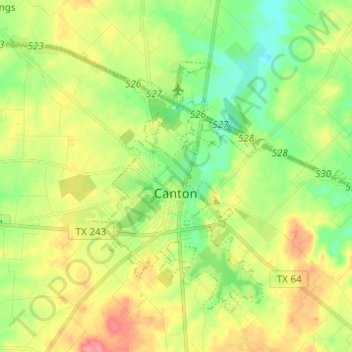
Name: Canton topographic map, elevation, terrain.

Location: Canton, Van Zandt County, Texas, 75103, United States (32.52055 -95.92709 32.60084 -95.80449)

Average elevation: 159 m

Minimum elevation: 125 m

Maximum elevation: 205 m

Gear up for your next adventure:

🗺️Topographic Maps - Detailed maps for hiking and navigation
⌛Survival Blankets - Emergency thermal blankets
🏕️Camping Gear - Essential camping equipment
🔋Solar Power Banks - Charge your phone and GPS using the sun while deep in the bush
🧭Global Orienteering Compass - High-precision liquid-filled compasses for accurate map reading and navigation

As an Amazon Associate, this site earns from qualifying purchases at no extra cost to you.