
Map Ta Phut topographic map
Interactive map
Click on the map to display elevation.
About this map
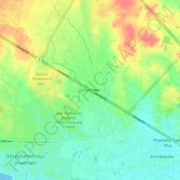
Name: Map Ta Phut topographic map, elevation, terrain.
Location: Map Ta Phut, Rayong, Rayong Province, 21150, Thailand (12.67749 101.12869 12.75749 101.20869)
Average elevation: 26 m
Minimum elevation: 2 m
Maximum elevation: 63 m