Geolocate

Melbourne topographic map

Click on the map to display elevation.

About this map
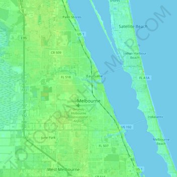
Name: Melbourne topographic map, elevation, terrain.

Location: Melbourne, Brevard County, Florida, United States (28.03501 -80.74826 28.20053 -80.57494)

Average elevation: 5 m

Minimum elevation: -2 m

Maximum elevation: 24 m

Gear up for your next adventure:

📻Handheld UHF Radios - Critical communication for groups in the Australian outback
⛺Ultralight Solo Tents - Compact shelters for multi-day topographic surveying expeditions
☀️Portable Solar Chargers - High-efficiency panels to hang on your backpack while walking
🥾Hiking Gaiters - Leg protection for trails
🏫Topographic World Globes - 3D physical relief globes to understand global geography

As an Amazon Associate, this site earns from qualifying purchases at no extra cost to you.