
Thank you for supporting this site ❤️
Make a donation
Make a donation
Gear up for your next adventure:
As an Amazon Associate, this site earns from qualifying purchases at no extra cost to you.
Hellín topographic map
Click on the map to display elevation.
Thank you for supporting this site ❤️
Make a donation
Make a donation
Gear up for your next adventure:
As an Amazon Associate, this site earns from qualifying purchases at no extra cost to you.
About this map
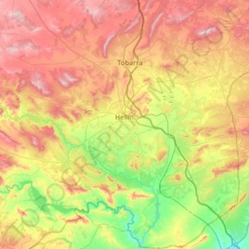
Name: Hellín topographic map, elevation, terrain.
Location: Hellín, Albacete, Castile-La Mancha, 02400, Spain (38.30874 -1.87625 38.68929 -1.47489)
Average elevation: 604 m
Minimum elevation: 276 m
Maximum elevation: 1,040 m
Thank you for supporting this site ❤️
Make a donation
Make a donation
Gear up for your next adventure:
As an Amazon Associate, this site earns from qualifying purchases at no extra cost to you.