Geolocate

Vaals topographic map

Click on the map to display elevation.

About this map

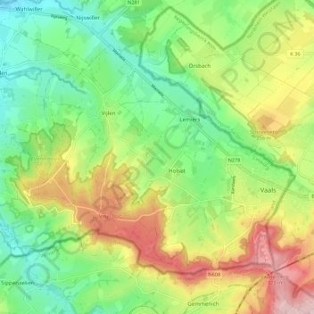
Name: Vaals topographic map, elevation, terrain.

Location: Vaals, Limburg, Netherlands (50.75276 5.92054 50.80344 6.02785)

Average elevation: 198 m

Minimum elevation: 102 m

Maximum elevation: 347 m

Other topographic maps

Click on a map to view its topography, its elevation and its terrain.

Berkelaar

Netherlands > Limburg > Echt

Average elevation: 27 m

Gear up for your next adventure:

🧣Merino Neck Gaiters - Versatile headwear for warmth, sun protection, or dust filtering
🌧️Rain Jackets - Waterproof jackets for hiking
🧭Compass - Navigation compasses for outdoor exploration
🍶Collapsible Water Bottles - Save space in your pack as you consume your water supply
🧰Survival Kits - Essential survival gear

As an Amazon Associate, this site earns from qualifying purchases at no extra cost to you.