Geolocate

Peterhead topographic map

Click on the map to display elevation.

About this map

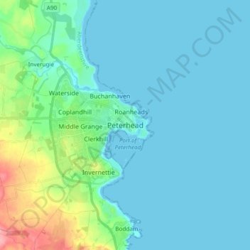
Name: Peterhead topographic map, elevation, terrain.

Location: Peterhead, Aberdeenshire, Scotland, AB42 1ZP, United Kingdom (57.46529 -1.82132 57.54529 -1.74132)

Average elevation: 17 m

Minimum elevation: 0 m

Maximum elevation: 105 m

Gear up for your next adventure:

🧯Animal Deterrent Spray - Safety spray for wildlife
🚴Bike GPS - GPS devices for cycling
🧴Sunscreen SPF - Sun protection for outdoor activities
👖Convertible Hiking Trousers - Zip-off legs to adapt to changing temperatures throughout the day
🔌Fast Charging Adapters - Quickly top up all your gear before heading back into the field

As an Amazon Associate, this site earns from qualifying purchases at no extra cost to you.