
Forest Hill topographic map
Interactive map
Click on the map to display elevation.
About this map
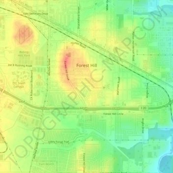
Name: Forest Hill topographic map, elevation, terrain.
Location: Forest Hill, Tarrant County, Texas, United States (32.64555 -97.29122 32.68819 -97.24080)
Average elevation: 198 m
Minimum elevation: 171 m
Maximum elevation: 223 m
Other topographic maps
Click on a map to view its topography, its elevation and its terrain.
Mansfield
United States > Texas > Tarrant County
Mansfield, Tarrant County, Texas, 76063, United States
Average elevation: 195 m
Forest Hill
United States > Texas > Tarrant County > Forest Hill > Forest Hill
Forest Hill, Tarrant County, Texas, 76119, United States
Average elevation: 195 m
Fort Worth
United States > Texas > Tarrant County
Fort Worth, Tarrant County, Texas, United States
Average elevation: 212 m
Arlington
United States > Texas > Tarrant County > Arlington
Arlington, Tarrant County, Texas, United States
Average elevation: 174 m