
Tilba Tilba topographic map
Interactive map
Click on the map to display elevation.
About this map
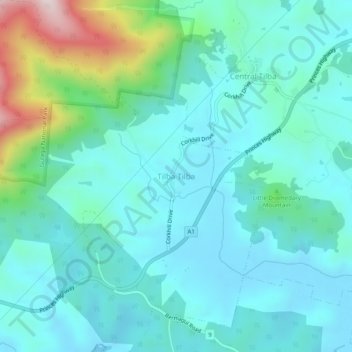
Name: Tilba Tilba topographic map, elevation, terrain.
Average elevation: 104 m
Minimum elevation: -4 m
Maximum elevation: 550 m
Other topographic maps
Click on a map to view its topography, its elevation and its terrain.
Dignams Creek
Australia > New South Wales > Tilba Tilba > Dignams Creek
Dignams Creek, Tilba Tilba, Eurobodalla Shire Council, New South Wales, 2546, Australia
Average elevation: 33 m