
Cape Patterson Coastal Reserve topographic map
Interactive map
Click on the map to display elevation.
About this map
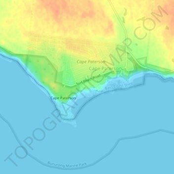
Name: Cape Patterson Coastal Reserve topographic map, elevation, terrain.
Average elevation: 12 m
Minimum elevation: 0 m
Maximum elevation: 40 m
Victoria trails, hiking, mountain biking, running and outdoor activities
Other topographic maps
Click on a map to view its topography, its elevation and its terrain.
Cape Patterson Nature Conservation Reserve
Australia > Victoria > Cape Paterson
Average elevation: 22 m