
Rivière Mistassibi topographic map
Interactive map
Click on the map to display elevation.
About this map
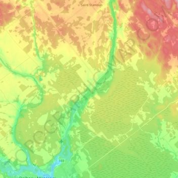
Name: Rivière Mistassibi topographic map, elevation, terrain.
Average elevation: 160 m
Minimum elevation: 103 m
Maximum elevation: 226 m
Other topographic maps
Click on a map to view its topography, its elevation and its terrain.
Lac Armand
Canada > Québec > Saint-Stanislas
Lac Armand, Chemin de l'Éden, Saint-Stanislas, Maria-Chapdelaine, Saguenay - Lac-Saint-Jean, Québec, Canada
Average elevation: 220 m