
Northwest Head topographic map
Interactive map
Click on the map to display elevation.
About this map
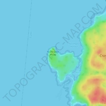
Name: Northwest Head topographic map, elevation, terrain.
Location: Northwest Head, Washington County, Maine, USA (44.61170 -67.32143 44.61180 -67.32133)
Average elevation: 8 m
Minimum elevation: -2 m
Maximum elevation: 59 m