
Speti topographic map
Interactive map
Click on the map to display elevation.
About this map
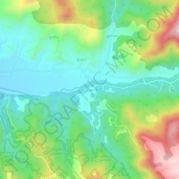
Name: Speti topographic map, elevation, terrain.
Location: Speti, Raion Sachkhere, Imereti, Georgia (42.30791 43.49740 42.34791 43.53740)
Average elevation: 657 m
Minimum elevation: 500 m
Maximum elevation: 995 m