Eschenbach (SG) topographic map
Interactive map
Click on the map to display elevation.
About this map
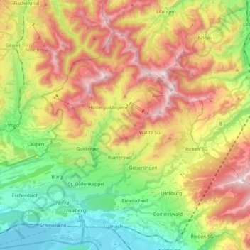
Name: Eschenbach (SG) topographic map, elevation, terrain.
Average elevation: 804 m
Minimum elevation: 401 m
Maximum elevation: 1,322 m

Click on the map to display elevation.
Name: Eschenbach (SG) topographic map, elevation, terrain.
Average elevation: 804 m
Minimum elevation: 401 m
Maximum elevation: 1,322 m