
Monaco topographic map
Interactive map
Click on the map to display elevation.
Monaco
The four traditional quartiers of Monaco are Monaco-Ville, La Condamine, Monte Carlo and Fontvieille. However, the suburb of Moneghetti, the high-level part of La Condamine, is generally seen today as an effective fifth Quartier of the Monaco, having a very distinct atmosphere and topography when compared with low-level La Condamine.
About this map
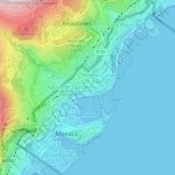
Name: Monaco topographic map, elevation, terrain.
Location: Monaco (43.72476 7.40903 43.75193 7.43987)
Average elevation: 105 m
Minimum elevation: -2 m
Maximum elevation: 504 m