
Mangalo topographic map
Interactive map
Click on the map to display elevation.
About this map
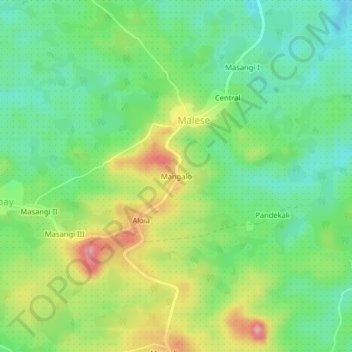
Name: Mangalo topographic map, elevation, terrain.
Location: Mangalo, Beni, North Kivu, DR Congo (0.49740 29.17238 0.53740 29.21238)
Average elevation: 941 m
Minimum elevation: 890 m
Maximum elevation: 1,025 m