
Datong topographic map
Interactive map
Click on the map to display elevation.
Datong
Datong is a prefecture-level city in northern Shanxi Province in the People's Republic of China. It is located in the Datong Basin at an elevation of 1,040 metres (3,410 ft) and borders Inner Mongolia to the north and west and Hebei to the east. It had a population of 3,318,057 during the 2010 census, of whom 1,629,035 lived in the built-up area made of the three urban districts of Chengqu, Kuangqu and Nanjiao.
About this map
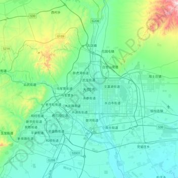
Name: Datong topographic map, elevation, terrain.
Average elevation: 1,149 m
Minimum elevation: 980 m
Maximum elevation: 1,990 m