
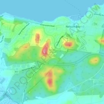
Gan Gan topographic map
Interactive map
Click on the map to display elevation.
About this map
Name: Gan Gan topographic map, elevation, terrain.
Average elevation: 30 m
Minimum elevation: -1 m
Maximum elevation: 140 m
Other topographic maps
Click on a map to view its topography, its elevation and its terrain.
Nelson Bay
Australia > New South Wales > Nelson Bay
Nelson Bay, Port Stephens Council, New South Wales, 2315, Australia
Average elevation: 12 m
Gan Gan Hill lookout
Australia > New South Wales > Nelson Bay > Gan Gan
Gan Gan Hill lookout, Lily Hill Road, Gan Gan, Nelson Bay, Port Stephens Council, New South Wales, 2315, Australia
Average elevation: 44 m
Tomaree National Park
Australia > New South Wales > Nelson Bay
Tomaree National Park, Nelson Bay, Port Stephens Council, New South Wales, 2315, Australia
Average elevation: 9 m