
Molesworth topographic map
Interactive map
Click on the map to display elevation.
About this map
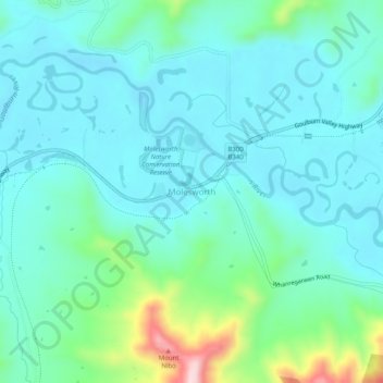
Name: Molesworth topographic map, elevation, terrain.
Location: Molesworth, Shire of Murrindindi, Victoria, Australia (-37.18777 145.51931 -37.14777 145.55931)
Average elevation: 218 m
Minimum elevation: 160 m
Maximum elevation: 460 m
Victoria trails, hiking, mountain biking, running and outdoor activities