
Sebastian County topographic map
Interactive map
Click on the map to display elevation.
About this map
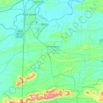
Name: Sebastian County topographic map, elevation, terrain.
Location: Sebastian County, Arkansas, USA (34.93011 -94.44640 35.45087 -94.03029)
Average elevation: 193 m
Minimum elevation: 113 m
Maximum elevation: 805 m
Other topographic maps
Click on a map to view its topography, its elevation and its terrain.