
Hirtshals topographic map
Interactive map
Click on the map to display elevation.
About this map
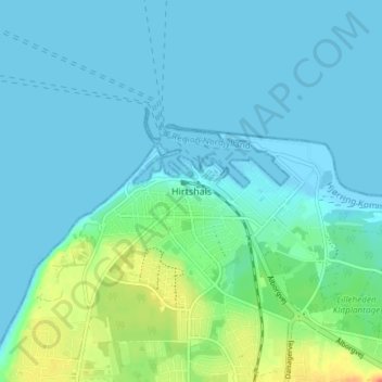
Name: Hirtshals topographic map, elevation, terrain.
Location: Hirtshals, Hjørring Kommune, Noord-Jutland, 9850, Denemarken (57.57080 9.94497 57.61080 9.98497)
Average elevation: 9 m
Minimum elevation: -1 m
Maximum elevation: 45 m