
Nevşehir merkez topographic map
Interactive map
Click on the map to display elevation.
About this map
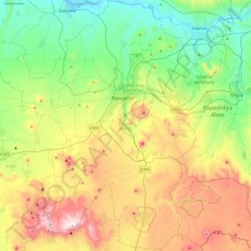
Name: Nevşehir merkez topographic map, elevation, terrain.
Location: Nevşehir merkez, Nevşehir, Central Anatolia Region, Turkey (38.41861 34.42677 38.75642 34.85224)
Average elevation: 1,285 m
Minimum elevation: 901 m
Maximum elevation: 1,977 m