
Chatham Valley topographic map
Interactive map
Click on the map to display elevation.
About this map
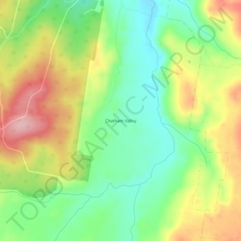
Name: Chatham Valley topographic map, elevation, terrain.
Location: Chatham Valley, Oberon Council, New South Wales, Australia (-33.86833 149.88111 -33.82833 149.92111)
Average elevation: 1,203 m
Minimum elevation: 1,128 m
Maximum elevation: 1,303 m
Other topographic maps
Click on a map to view its topography, its elevation and its terrain.
Chatham Valley
Australia > New South Wales > Chatham Valley
Chatham Valley, Oberon Council, New South Wales, 2787, Australia
Average elevation: 1,216 m